Hail history in West Virginia
NOAA hail reports within 15 miles of the center of Huntington since 2010: 36 hail days, largest 3.0 in.
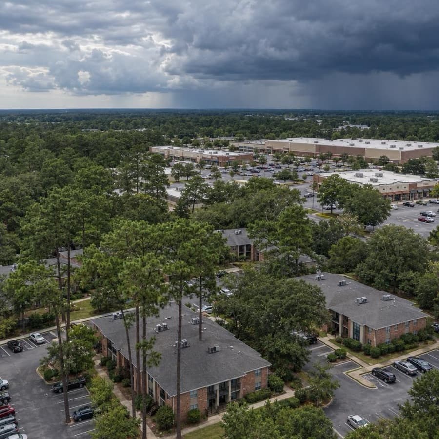
- Hail days near Huntington since 2010, the most in West Virginia
- 36
- Largest hail reported, near Huntington
- 3.0 in
- West Virginia city tracked
- 1
Source: NOAA/NWS Storm Prediction Center
Data through November 1, 2026
West Virginia cities by hail days
Source: NOAA/NWS Storm Prediction Center
Data through November 1, 2026
| City | Hail days since 2010 | Largest hail |
|---|---|---|
| Huntington | 36 | 3.0 in |
About this data
- Each city counts reports within 15 miles of its center, not of any one property.
- Reports come from trained spotters and the public, so they cluster near towns and roads.
- No report does not mean no hail. Hail can fall where no one is there to report it.
- This is not a damage or insurance assessment.
Storm risk in West Virginia
Flooding is the costliest and most severe natural hazard for West Virginia, the state climate summary says, and NWS Charleston calls it the biggest overall weather threat in its region. Damaging thunderstorm wind follows, then hail, heavy snow and ice, and occasional tornadoes.2,4 About 7.4 percent of the state's primary buildings sit in the 1 percent annual chance floodplain, and the mountains get some of the highest snowfall east of the Mississippi River, an average of 100 inches a year.5,2
How often storms hit West Virginia
| Hazard | How often | What it means for buildings |
|---|---|---|
| Flooding | 82,408 of the state's 1,118,761 primary buildings, 7.4 percent, are in the 1 percent annual chance floodplain, and 8,237 of those are in floodways. 64 flood disasters were federally declared from 1953 to 2024. Remnants of hurricanes add heavy rain. | River floods soak ground floors, basements and mechanical rooms. Flash floods on small streams can sweep buildings away, including outside mapped flood zones. |
| Damaging thunderstorm wind | Damaging wind reports on 45 days a year on average within 124 nautical miles of the Charleston radar (1980 to 2006). Derechos, widespread straight-line windstorms, have left customers without power for more than a week. | NWS Charleston says thunderstorm gusts frequently damage trees, causing property damage and power outages. Wind also lifts roof edges and membranes and topples rooftop equipment. |
| Hail | 36 hail days since 2010 within 15 miles of Huntington, the one West Virginia city on this page, with hail up to 3 inches. Around the Charleston radar, hail reports came on 28 days a year on average (1980 to 2006). | NWS Charleston says most hailstones are 1 inch across or smaller and damage vehicles most often, but larger hail breaks roofs, siding and windows. |
| Tornadoes | About 3 a year from 1995 to 2024, though 2024 set a record with 21. At any one point near the Charleston radar, the yearly chance of a tornado is 0.004 percent. | A direct hit on one building is rare, but NWS Charleston's records include several intense, long-tracked tornadoes. |
| Winter storms and cold | An average of 100 inches of snow a year in the mountains, plus ice storms and nor'easters. The state averages 3.9 nights a year at 0°F or below. | FEMA says drifting snow and rain on snow can overload roofs. Ice, cold and outages freeze pipes and sprinkler lines. |
The hail count is days with at least one hail report within 15 miles of Huntington's center since 2010, so it shows how often hail falls near the city, not on any one building. The Storm Prediction Center radar figures cover a far larger circle, 124 nautical miles around the Charleston radar, and come from 1980 to 2006 reports.1,3
For an owner, wind and hail bring frequent roof and tree damage, while a flood is less frequent at any one address but can cause the largest single loss, and in steep valleys it can arrive with little warning.
Rules owners in West Virginia should know
- FAIR Plan: the West Virginia Essential Property Insurance Association insures owners who can't get coverage in the voluntary market, with proof of their effort. Cover is limited to fire, lightning, riot, explosion, vehicle, smoke, hail, aircraft and wind, up to $200,000 for any one habitational risk and $500,000 for any one commercial risk, and liability coverage is not available.7,8
- Claim timing (114CSR14): an insurer must acknowledge a claim within 15 working days, start investigating within 15 working days, and deny in writing or make a written offer within 10 working days of finishing its investigation. If it needs more than 30 calendar days after proof of loss to decide, it must explain in writing and update the claimant every 45 calendar days.9
- Claim notice: except where a statute or legislative rule sets a time limit, an insurer may not require a first-party claimant to give notice of a claim or proof of claim within a specified time (114CSR14).9
- Suit deadline (W. Va. Code 33-6-14): a policy can't limit the time to sue to less than two years after the cause of action accrues, and a shorter clause is void. The section does not apply to the standard fire insurance policy.10
- Public adjusters (114CSR25): any fee must be reasonable. After a catastrophe it can't exceed 10 percent of the settlement, and no fee or deposit may be taken before the claim is settled.11
Before the next storm
- Flood lookup: check each building on the WV Flood Tool, which shows the flood zone, flood height and estimated flood depth for an address from FEMA's flood maps. Its own rule is "if in doubt, it's not out."12
- Flood coverage: NFIP flood coverage usually starts 30 days after purchase, and commercial building and contents coverage each go up to $500,000. The state's flood risk study notes that flash flooding on small streams reaches buildings outside mapped zones too.13,6
- Trees and roof edges: trim or remove trees that could fall on buildings, and have single-ply roofs fitted with a perimeter peel-stop 1 to 2 feet from the edge, as IBHS recommends. NWS Charleston says thunderstorm gusts frequently damage trees, causing property damage.4,14
- Snow loads: have a structural engineer verify the snow load each roof can carry, as IBHS advises, and after heavy snow watch for FEMA's warning signs of overload: sagging ceiling tiles or sprinkler lines, popping or creaking noises, and doors or windows that stick.14,15
Sources
Written by the Cloudbreak team. Numbers, dates and rules cite the published sources below.
- 1. Cloudbreak: NOAA/NWS Storm Prediction Center storm reports, as counted on the Cloudbreak hail history page for West Virginia
- 2. NOAA NCEI and North Carolina Institute for Climate Studies: West Virginia: 2025 State Climate Summaries
- 3. NOAA Storm Prediction Center: RLX (Charleston) Severe Weather Climatology, 1980 to 2006
- 4. NWS Charleston, WV: Natural Hazard Risk Assessment
- 5. WV GIS Technical Center, West Virginia University: 30 Fast Facts about Flooding in West Virginia (April 2025)
- 6. WV GIS Technical Center, West Virginia University: Building Counts Risk Indicator, West Virginia Flood Risk Assessment (2024)
- 7. West Virginia Offices of the Insurance Commissioner: Fair Plan
- 8. West Virginia Insurance Commissioner: 114CSR21: West Virginia Essential Property Insurance Association
- 9. West Virginia Insurance Commissioner: 114CSR14: Unfair Trade Practices
- 10. West Virginia Legislature: W. Va. Code 33-6-14: Certain policy conditions voided
- 11. West Virginia Insurance Commissioner (text via Cornell LII): W. Va. Code R. 114-25-12: Public Adjuster Fees
- 12. mapWV, State of West Virginia: WV Flood Tool
- 13. FEMA National Flood Insurance Program: What you need to know about buying flood insurance
- 14. Insurance Institute for Business & Home Safety (IBHS): Commercial Roofs Best Practices Guide
- 15. FEMA: Snow Load Safety Guidance (FEMA P-957)
Storms in West Virginia
NWS Charleston says damaging thunderstorm winds are the severe storm hazard people in its area meet most often, and that storms able to produce hail are most common in spring and late summer.1
Notable storms
- April 2, 2024Storms produced 10 tornadoes in West Virginia, a one-day state record. Huntington Tri-State Airport measured a 92 mph gust, the station's highest on record. An EF2 tornado with 130 mph winds near Hico in Fayette County damaged or destroyed several homes and businesses along US 60, and a 90 mph macroburst damaged roofs on a few buildings in South Charleston.2
- May 23, 2019Hail up to 4.25 inches across fell near Pinch in Kanawha County, and 3-inch hail fell near Jodie in Fayette County, denting many cars. NOAA's Storm Events Database lists $500,000 in property damage near Pinch and $250,000 near Jodie.3,4
- April 8, 2019Hail from 1 to 3 inches across fell near Colored Hill in Mercer County. NOAA's Storm Events Database says the hail damaged roof coverings and vehicles.5
- April 28, 2016Hail up to baseball size fell in a narrow strip of Taylor County around Grafton. Over 800 vehicles were damaged and about 260 buildings were hit, mostly with window, roof or siding damage. NOAA's Storm Events Database lists $3.8 million in property damage.6,1
- June 29, 2012A derecho crossed the state with gusts of 78 mph at Charleston's airport, 68 mph at Beckley and 66 mph at Clarksburg, and about 670,000 customers in West Virginia lost power. In Kanawha County, 7 homes were destroyed and 20 had major damage.7,8
- March 2, 2012An EF3 tornado crossed from Kentucky into Wayne County on a path almost 53 miles long. It destroyed about 20 homes, including mobile and manufactured homes, near Dunlow, Kiahsville and Cove Gap.9,10
Warnings and alerts
NWS Charleston covers most of West Virginia, including Huntington. NWS Pittsburgh covers nine northern counties from Hancock to Tucker, NWS Baltimore/Washington covers Berkeley, Grant, Hampshire, Hardy, Jefferson, Mineral, Morgan and Pendleton counties, and NWS Blacksburg, Virginia, covers Greenbrier, Mercer, Monroe and Summers counties.11
Sources
- 1. NWS Charleston, WV: Natural Hazard Risk Assessment
- 2. NWS Charleston, WV: Information on the Record-Breaking April 2nd Tornadoes and Wind Damage
- 3. NOAA NCEI: Storm Events Database: Kanawha County hail, May 23, 2019
- 4. NOAA NCEI: Storm Events Database: Fayette County hail, May 23, 2019
- 5. NOAA NCEI: Storm Events Database: Mercer County hail, April 8, 2019
- 6. NOAA NCEI: Storm Events Database: Taylor County hail, April 28, 2016
- 7. NWS Charleston, WV: Derecho Event of June 29th, 2012
- 8. NOAA NCEI: Storm Events Database: Kanawha County thunderstorm wind, June 29, 2012
- 9. NWS Charleston, WV: Summary of the March 2nd 2012 Tornadic Supercells
- 10. NOAA NCEI: Storm Events Database: Wayne County tornado, March 2, 2012
- 11. National Weather Service: Eastern Region public forecast zones by county and office
Hail history in other states
- Alabama
- Alaska
- Arizona
- Arkansas
- California
- Colorado
- Connecticut
- District of Columbia
- Florida
- Georgia
- Hawaii
- Idaho
- Illinois
- Indiana
- Iowa
- Kansas
- Kentucky
- Louisiana
- Maine
- Maryland
- Massachusetts
- Michigan
- Minnesota
- Mississippi
- Missouri
- Montana
- Nebraska
- Nevada
- New Hampshire
- New Jersey
- New Mexico
- New York
- North Carolina
- North Dakota
- Ohio
- Oklahoma
- Oregon
- Pennsylvania
- Rhode Island
- South Carolina
- South Dakota
- Tennessee
- Texas
- Utah
- Virginia
- Washington
- Wisconsin
- Wyoming