Hail history in Maine
NOAA hail reports within 15 miles of the center of Portland since 2010: 14 hail days, largest 2.0 in.
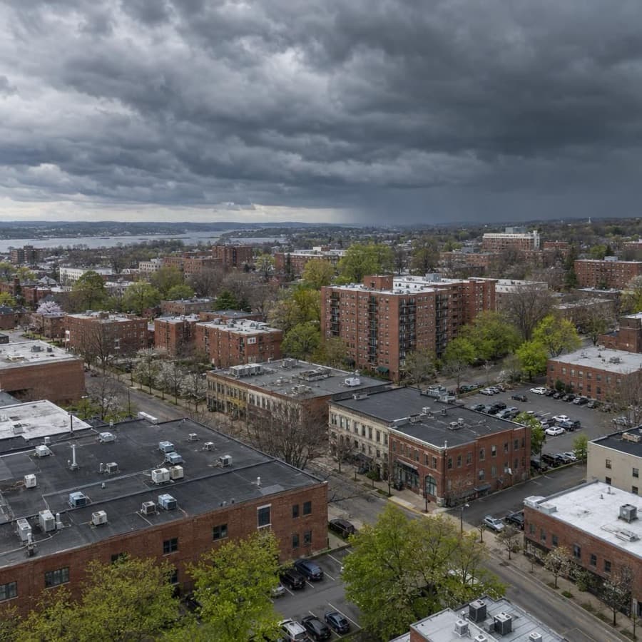
- Hail days near Portland since 2010, the most in Maine
- 14
- Largest hail reported, near Portland
- 2.0 in
- Maine city tracked
- 1
Source: NOAA/NWS Storm Prediction Center
Data through November 1, 2026
Maine cities by hail days
Source: NOAA/NWS Storm Prediction Center
Data through November 1, 2026
| City | Hail days since 2010 | Largest hail |
|---|---|---|
| Portland | 14 | 2.0 in |
About this data
- Each city counts reports within 15 miles of its center, not of any one property.
- Reports come from trained spotters and the public, so they cluster near towns and roads.
- No report does not mean no hail. Hail can fall where no one is there to report it.
- This is not a damage or insurance assessment.
Storm risk in Maine
For commercial and multifamily buildings in Maine, the storms that matter most are fall and winter storms, including nor'easters, which bring heavy snow, ice, damaging wind and coastal flooding; the state hazard plan says all of Maine is exposed to them every year, on a larger scale than summer storms. Inland flooding, summer thunderstorm wind and the occasional tropical storm follow.2 Hail and tornadoes matter less: the state plan calls the impact of hail historically limited and tornadoes rare. Maine had more power outages than any other state on average from 2015 to 2019.2
How often storms hit Maine
| Hazard | How often | What it means for buildings |
|---|---|---|
| Winter storms and nor'easters | More than 200 winter storm events, more than 400 heavy snow events and 12 ice storms since 1996. Nor'easters are most frequent from September to April, and coastal areas get more ice storms and blizzard conditions. | Heavy snow loads can collapse roofs, ice brings down trees and power lines, and nor'easters push coastal flooding onto low waterfront property. |
| Flooding | Low-lying flood areas cover 2,184 square miles, 6.2 percent of the state. Major floods come from heavy rain, snowmelt and ice jams, and the Kennebec and Androscoggin are the most vulnerable rivers. | Floodwater damages ground floors, basements and mechanical rooms along rivers and the coast. |
| Damaging thunderstorm wind | Damaging wind reports on 17 days a year on average within 124 nautical miles of the Portland radar (1980 to 2006). | Straight-line wind does most of its damage by dropping trees onto buildings and power lines, and outages can spread well beyond the storm. |
| Hurricanes and tropical storms | 65 tropical systems have passed through Maine since 1851, and five made direct landfall on the Maine coast as hurricanes. 152 local jurisdictions in ten counties from York to Washington are exposed to storm surge. | Most arrive weakened but still bring wind, inland flooding and surge, even without landfall in Maine. |
| Hail | 14 hail days since 2010 within 15 miles of Portland's center, with hail up to 2 inches. Statewide, 1,163 reports of hail 3/4 inch or larger since 1957, about 23 percent of them larger than 1 inch. | Large stones can still crack roof covers, skylights and rooftop unit fins. |
| Tornadoes | 139 since 1950, an average of 1.96 a year. None has been rated F3 or stronger, and 19 were F2. | Rare and usually weak, though an F2 can tear roofs off. |
The Portland hail count is days with at least one hail report within 15 miles of the city's center since 2010, not hits on one building. The radar figures cover a much larger circle, 124 nautical miles around the Portland radar, and come from 1980 to 2006 reports.1,3
For most Maine owners, the costly storms are the big fall and winter systems rather than summer hail. One nor'easter can bring wind, snow load, ice and coastal flooding at once, and a long power outage in cold weather leaves pipes open to freezing.2,15
Rules owners in Maine should know
- Claim payment: Under 24-A M.R.S. §2436, a claim is payable within 30 days after the insurer receives proof of loss and the amount is agreed in writing or set by an arbitration award, or 60 days for the fire portion of a policy. An undisputed claim paid late bears interest of 1.5 percent a month.5
- Unfair claim practices: 24-A M.R.S. §2436-A lets an insured sue its own insurer for listed practices, such as failing to affirm or deny coverage within a reasonable time after finishing its investigation, or failing without just cause to settle promptly once liability is reasonably clear. A successful claimant recovers damages, costs, reasonable attorney's fees and interest of 1.5 percent a month.6
- Fire policy terms: Every fire insurance policy on Maine property must use the Maine standard fire policy terms (24-A M.R.S. §3002). They call for a sworn proof of loss within 60 days after the loss unless the insurer extends it in writing, and bar a suit on the policy unless it starts within two years after the inception of the loss.7
- Hurricane deductibles: Bureau of Insurance Rule 960 lets a hurricane deductible apply only from the time the National Weather Service issues a hurricane warning for the forecast zone that includes the property's town until 24 hours after the last warning ends, whether or not hurricane-force winds reach the property, and an insurer can't also apply a windstorm deductible to the same loss. The rule covers policies under the Property Insurance Cancellation Control Act, which reaches only owner-occupied residential buildings of up to 4 apartments.8,9,17
- Building code: The Maine Uniform Building and Energy Code (MUBEC) covers new and existing residential and commercial buildings and has used the 2021 International Building and Existing Building Codes since April 7, 2025. Towns of more than 4,000 people must enforce it, but compliance is mandatory and the owner's responsibility even where a town doesn't.10,11
- Coastal rebuilding: Within 75 feet of the high-water line, or in a coastal sand dune system, storm repairs may need a DEP permit under the Natural Resources Protection Act. Repairing less than 50 percent of a structure needs none if its size doesn't grow; replacing it, or repairing more, needs a permit by rule. On a frontal dune, a building severely damaged by ocean storm waves must be moved back from the beach where practicable, and its footprint can't grow (06-096 CMR ch. 355, §6).12,13
Before the next storm
- Hurricane deductible check: Before the Atlantic hurricane season, which runs June 1 to November 30, find out whether each policy has a hurricane or named storm deductible and whether it applies per event, per season or per year. The Maine Bureau of Insurance warns it may have to be paid more than once if several storms hit.14,4
- Snow on the roof: IBHS advises having snow removed once the estimated load passes 20 to 25 pounds per square foot, and notes that drifts pile up at parapets, rooftop units and next to taller buildings. About 10 to 12 inches of new snow, 3 to 5 inches of packed snow or 1 inch of ice each add about 5 pounds per square foot.15
- Heat during outages: IBHS advises keeping a building at 55°F or more and never letting it fall below 40°F, and backup power helps hold that temperature. That matters in Maine, which led the states in power outages on average from 2015 to 2019.15,2
- Flood coverage timing: NFIP flood policies take effect 30 days after purchase, with few exceptions, so coverage has to be in place well before a storm is forecast.16
Sources
Written by the Cloudbreak team. Numbers, dates and rules cite the published sources below.
- 1. Cloudbreak: NOAA/NWS Storm Prediction Center storm reports, as counted on the Cloudbreak hail history page for Maine
- 2. Maine Emergency Management Agency: 2023 Maine State Hazard Mitigation Plan, Section 3: Risk Assessment
- 3. NOAA Storm Prediction Center: GYX (Portland, Maine) Severe Weather Climatology, 1980 to 2006
- 4. Maine Bureau of Insurance: Storm Related Claims FAQs
- 5. Maine Legislature: 24-A M.R.S. §2436: Interest on overdue payments
- 6. Maine Legislature: 24-A M.R.S. §2436-A: Unfair claims settlement practices
- 7. Maine Legislature: 24-A M.R.S. §3002: Standard fire policy required
- 8. Maine Bureau of Insurance (text via Cornell LII): 02-031 CMR ch. 960, §4: Standards for Hurricane Deductibles
- 9. Maine Legislature: 24-A M.R.S. §3048: Scope of subchapter (Maine Property Insurance Cancellation Control Act)
- 10. Maine Office of Community Affairs: Division of Building Codes and Standards
- 11. Maine Department of Energy Resources: Building and Energy Codes
- 12. Maine Department of Environmental Protection: Permitting Storm Clean-up, Repair and Rebuilding Activities
- 13. Maine Department of Environmental Protection (text via Cornell LII): 06-096 CMR ch. 355, §6: Standards for frontal dune projects
- 14. NOAA National Hurricane Center: Tropical Cyclone Climatology
- 15. Insurance Institute for Business & Home Safety (IBHS): Commercial Risk Engineering Bulletin: Winter Weather
- 16. FEMA National Flood Insurance Program (FloodSmart): What you need to know about buying flood insurance
- 17. Maine Legislature: 24-A M.R.S. §3061: Uniform policy standards concerning hurricane deductible programs
Storms in Maine
Around the Portland radar, SPC counts for 1980 to 2006 show hail and damaging wind reports falling almost entirely from May through August and peaking in July, with less than a quarter as many reports around the Caribou radar in the north.1,2
Notable storms
- January 13, 2024A 3.37-foot storm surge pushed Portland's tide to 14.57 feet, the highest on records back to 1912, three days after another storm brought the third highest. Waves damaged homes in Wells, Saco, Old Orchard Beach and Scarborough, and NOAA lists $30 million in property damage in coastal York County and $20 million in coastal Cumberland County.3,4,5
- October 30, 2017Gusts reached 69 mph at Portland, 66 mph at Bangor and 73 mph at Brooklin, and winds toppled or snapped trees estimated in the hundreds of thousands from Hancock County to Piscataquis County. Almost 500,000 customers lost power, the Bangor Daily News reported.6,7,8
- August 11, 2016An early morning storm dropped hail up to 1.5 inches around Caribou, denting hundreds of vehicles and breaking windows. NOAA's Storm Events Database puts the vehicle damage at about $1 million.9
- July 19, 2015Afternoon storms dropped 2.75-inch hail in North Berwick in York County and 1.5-inch hail in Naples in Cumberland County.10,11
- July 15, 2014A microburst with gusts estimated at 80 mph hit York village, snapping or uprooting hundreds of trees. Two homes had major damage and 12 had moderate to minor damage, and NOAA lists $1.4 million in property damage.12
- June 1, 2011Storms dropped 2.75-inch hail in Kingfield, and an EF1 tornado with winds estimated at 90 to 100 mph tracked about 8.4 miles from New Portland through Embden, damaging several buildings.13,14
Warnings and alerts
NWS Caribou covers Aroostook, Piscataquis, Penobscot, Washington and Hancock counties and northern Somerset County, and NWS Portland covers the rest of the state.15 Maine.gov's Citizen Alert System sends alerts from state officials about urgent events by email or text to people who sign up.16
Sources
- 1. NOAA Storm Prediction Center: GYX Severe Weather Climatology (Portland radar, 1980 to 2006)
- 2. NOAA Storm Prediction Center: CBW Severe Weather Climatology (Caribou radar, 1980 to 2006)
- 3. NOAA NCEI: Storm Events Database: Coastal Flood, Coastal York County, January 13, 2024
- 4. NOAA NCEI: Storm Events Database: Coastal Flood, Coastal Cumberland County, January 13, 2024
- 5. NOAA NCEI: Storm Events Database: Coastal Flood, Coastal York County, January 10, 2024
- 6. NOAA NCEI: Storm Events Database: High Wind, Coastal Cumberland County, October 30, 2017
- 7. NOAA NCEI: Storm Events Database: High Wind, Coastal Hancock County, October 30, 2017
- 8. Bangor Daily News: Nor'easter knocked power out to fewer than half as many people as 2017 windstorm
- 9. NOAA NCEI: Storm Events Database: Hail, Caribou, August 11, 2016
- 10. NOAA NCEI: Storm Events Database: Hail, North Berwick, July 19, 2015
- 11. NOAA NCEI: Storm Events Database: Hail, Naples, July 19, 2015
- 12. NOAA NCEI: Storm Events Database: Thunderstorm Wind, York, July 15, 2014
- 13. NOAA NCEI: Storm Events Database: Hail, Kingfield, June 1, 2011
- 14. NOAA NCEI: Storm Events Database: EF1 Tornado, Somerset County, June 1, 2011
- 15. National Weather Service: Maine County Warning Forecast Areas
- 16. State of Maine (Maine.gov): Citizen Alert System
Hail history in other states
- Alabama
- Alaska
- Arizona
- Arkansas
- California
- Colorado
- Connecticut
- District of Columbia
- Florida
- Georgia
- Hawaii
- Idaho
- Illinois
- Indiana
- Iowa
- Kansas
- Kentucky
- Louisiana
- Maryland
- Massachusetts
- Michigan
- Minnesota
- Mississippi
- Missouri
- Montana
- Nebraska
- Nevada
- New Hampshire
- New Jersey
- New Mexico
- New York
- North Carolina
- North Dakota
- Ohio
- Oklahoma
- Oregon
- Pennsylvania
- Rhode Island
- South Carolina
- South Dakota
- Tennessee
- Texas
- Utah
- Virginia
- Washington
- West Virginia
- Wisconsin
- Wyoming