Hail history in South Dakota
We counted the days with NOAA hail reports within 15 miles of the center of 2 South Dakota cities since 2010.
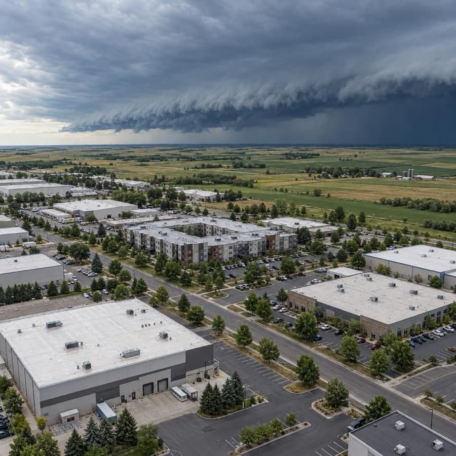
- Hail days near Rapid City since 2010, the most in South Dakota
- 199
- Largest hail reported, near Rapid City
- 4.5 in
- South Dakota cities tracked
- 2
Source: NOAA/NWS Storm Prediction Center
Data through November 1, 2026
South Dakota cities by hail days
Source: NOAA/NWS Storm Prediction Center
Data through November 1, 2026
| City | Hail days since 2010 | Largest hail |
|---|---|---|
| Rapid City | 199 | 4.5 in |
| Sioux Falls | 59 | 3.5 in |
About this data
- Each city counts reports within 15 miles of its center, not of any one property.
- Reports come from trained spotters and the public, so they cluster near towns and roads.
- No report does not mean no hail. Hail can fall where no one is there to report it.
- This is not a damage or insurance assessment.
Storm risk in South Dakota
For commercial and multifamily buildings in South Dakota, hail and damaging thunderstorm wind are the most frequent storm risks, followed by tornadoes, blizzards and deep cold, and flooding from snowmelt and heavy rain. South Dakota had 232 large hail events in 2025, the seventh most of any state, and it shares with North Dakota and Nebraska the highest yearly chance of a blizzard in the US.2,6
How often storms hit South Dakota
| Hazard | How often | What it means for buildings |
|---|---|---|
| Hail | 232 hail events with stones 1 inch or larger in 2025, the seventh most of any state (5,432 in the US). Sioux Falls had hail on 59 days since 2010 within 15 miles of the city center, with stones up to 3.5 inches. | Roof covers, skylights and rooftop HVAC condenser fins take the hits, and the same roof can be struck more than once in a season. |
| Damaging thunderstorm wind | Damaging wind reports on 34 days a year on average within 124 nautical miles of the Sioux Falls radar and 24 around the Rapid City radar (1980 to 2006). | Straight-line gusts peel roof edges and membranes, shift rooftop units and can tear whole roofs off. |
| Tornadoes | About 35 a year on average (2001 to 2010 data). At any one point around the Sioux Falls radar, the yearly chance of a tornado is 0.023 percent. | A direct hit on one building is rare, but across a portfolio the odds add up, and strong tornadoes can destroy a structure. |
| Flooding | Spring snowmelt floods the James, Vermillion and Big Sioux rivers, thunderstorms cause flash floods in the Black Hills, and the Missouri River flooded along its entire length in 2011. In June 2024, more than 13 inches of rain over 3 days in the southeast sent the Big Sioux River more than 7 feet above its previous record. | Water reaches ground floors, basements, mechanical rooms and parking, and snowmelt floods can return in any year with a deep snowpack. |
| Winter storms and extreme cold | South Dakota, North Dakota and Nebraska have the highest chance in the US, more than 50 percent, of a blizzard somewhere in the state in any year. Days that stay at or below 0°F average 3.2 a year statewide (1900 to 2024). | Drifts pile extra snow load beside parapets, at roof steps and around rooftop equipment, and long cold snaps freeze pipes and sprinkler lines. |
The Sioux Falls count is days with at least one hail report within 15 miles of the city center since 2010, so it shows how often hail falls near the city, not on one building. The Storm Prediction Center radar figures cover a far larger circle, 124 nautical miles around each radar, and come from 1980 to 2006 reports.1,3,4
For an owner, hail and straight-line wind cause the frequent, repeat damage to roofs and rooftop equipment, blizzards and deep cold add snow load and freeze damage, and tornadoes and floods are rarer at any one address but cause the largest single losses.
Rules owners in South Dakota should know
- Claim response: SDCL 58-33-67 makes it an unfair practice for an insurer to fail to acknowledge and act within 30 days on communications about a claim, and SDCL 58-12-34 adds failing to provide claim forms within 15 days of a request. The Division of Insurance notes the 30-day rule does not require the claim to be paid within that time.8,10,9
- Attorney fees: Under SDCL 58-12-3, if an insurer's refusal to pay the full amount of a loss is vexatious or without reasonable cause and the policyholder wins, the court must allow a reasonable attorney's fee, unless the insurer tendered at least the amount recovered before the suit began.11
- Suit deadline: SDCL 53-9-6 voids any contract provision that limits the time to enforce it in court, and SDCL 15-2-13 allows six years for an action on a contract unless a statute sets a different limit. The Division of Insurance notes a policy may still require notice of a claim within a set time.12,13,9
- Building codes: A city or county code for buildings other than one- and two-family homes and townhouses of up to three stories must comply with the 2024 International Building Code (SDCL 11-10-5 and 11-10-12). Where no such code is adopted, buildings started after July 1, 2026 must still be designed to that code (SDCL 11-10-6).14,15,16
Before the next storm
- Hail-rated roofs: When reroofing, choose covers IBHS recommends for hail-prone areas, FM 4470 Class 1-SH or UL 2218 Class 4 on low-slope roofs, and fit hail guards over rooftop condenser fins and air intakes. South Dakota had the seventh most large hail events of any state in 2025.17,2
- Roof snow loads: After a blizzard, have a qualified person check where drifts collect, beside parapets, at roof steps and around rooftop equipment, since FEMA says uneven drifted snow can overload a roof. FEMA says to evacuate and call a design professional if ceilings sag, sprinkler heads drop below the ceiling or doors stop closing.18
- Freeze alarms: Before winter, install a system that alerts staff when a building's temperature drops below a set point, keep heat in sprinkler valve rooms, and hold vacant space at 55°F and never below 40°F, as IBHS recommends.19
- Flood coverage dates: Look up each building's flood zone and flood coverage during winter, before the spring melt. FEMA says a new flood policy typically has a 30-day waiting period before it takes effect.20
Sources
Written by the Cloudbreak team. Numbers, dates and rules cite the published sources below.
- 1. Cloudbreak: NOAA/NWS Storm Prediction Center storm reports, as counted on the Cloudbreak hail history page for South Dakota
- 2. Insurance Information Institute (Triple-I): Facts + Statistics: Hail
- 3. NOAA Storm Prediction Center: FSD (Sioux Falls) Severe Weather Climatology, 1980 to 2006
- 4. NOAA Storm Prediction Center: UDX (Rapid City) Severe Weather Climatology, 1980 to 2006
- 5. NWS Aberdeen: South Dakota Tornadoes: 2013
- 6. NOAA NCEI and North Carolina Institute for Climate Studies: South Dakota: 2025 State Climate Summaries
- 7. NOAA National Weather Service: Flooding in South Dakota
- 8. South Dakota Legislature: SDCL 58-33-67: Unfair or deceptive practices in dealing with insured
- 9. South Dakota Division of Insurance: Make the Claims Process Easier
- 10. South Dakota Legislature: SDCL 58-12-34: Acts constituting unfair claims practices
- 11. South Dakota Legislature: SDCL chapter 58-12, Insurance Claims and Benefits (58-12-3: Attorney fees)
- 12. South Dakota Legislature: SDCL 53-9-6: Restraints on legal proceedings void
- 13. South Dakota Legislature: SDCL 15-2-13: Six-year limitation for contract actions
- 14. South Dakota Legislature: SDCL chapter 11-10, Building Codes (11-10-5: Non-residential construction standards)
- 15. South Dakota Legislature: SDCL 11-10-6: No building code ordinance, International Building Code applied
- 16. South Dakota Legislature: SDCL 11-10-12: Residential structures
- 17. Insurance Institute for Business & Home Safety (IBHS): Commercial Roofs Best Practices Guide
- 18. FEMA: Snow Load Safety Guidance (FEMA P-957)
- 19. Insurance Institute for Business & Home Safety (IBHS): Commercial Risk Engineering Bulletin: Winter Weather
- 20. FEMA: Waiting Period for Activating Flood Policy?
Storms in South Dakota
In western South Dakota, large hail is the most common severe hazard, especially near and just east of the Black Hills, and most severe weather warnings come from late May through August, NWS Rapid City says.1
Notable storms
- August 11, 2026Hail up to 4 inches across fell northwest of Oglala, and around Oglala and Pine Ridge it smashed windows in homes and vehicles and damaged roofs. Gusts reached 111 mph near Newell, and winds caused structural damage and blew roofs partly or fully off homes and businesses around White River, Mission and Rosebud, NWS Rapid City says.2
- July 18, 2023An estimated 5-inch hailstone, the largest on record in Hughes County, fell on the south side of Pierre amid many reports of baseball-size hail around Pierre and Fort Pierre, damaging vehicles and roofs. A 100 mph gust was measured just west of Oacoma that evening, and trailers and other property were damaged in and around the town, NWS Aberdeen says.3
- May 12, 2022A derecho brought gusts of 107 mph at Tripp, 97 mph at Madison and 90 mph at Huron. NWS Sioux Falls reports roofs torn off buildings in Dante, Hartford and Canton and widespread damage to houses and roofs in Brookings. An EF2 tornado with 120 mph winds destroyed or badly damaged several structures in Castlewood, NWS Aberdeen says.4,5
- September 10, 2019Three tornadoes touched down in Sioux Falls late at night, and nine people were hurt in storms around the city. An EF2 tore off most of the roof of a multi-story apartment building and the roof of a strip mall near 41st Street. NOAA's Storm Events Database lists $6.8 million in property damage from another EF2, near Interstates 29 and 229.6,7
- August 30, 2013Softball-size hail, 4.25 inches across, damaged buildings and vehicles along Norris Peak Road near Johnson Siding, and hail caused extensive damage to homes and vehicles on Rapid City's west side. NOAA's Storm Events Database lists $12 million in property damage for one Rapid City hail report and $10 million for another.8,9,10
- July 23, 2010A hailstone 8 inches across and weighing 1.9375 pounds fell near Vivian, setting US records for diameter and weight, NWS Aberdeen says. Hail and winds over 70 mph damaged homes, outbuildings and vehicles across the area, and some stones went through roofs and garages.11,12
Warnings and alerts
NWS Rapid City covers western South Dakota, NWS Aberdeen the northern and central counties including Aberdeen and Pierre, and NWS Sioux Falls the southeast, including Sioux Falls.13
Sources
- 1. NWS Rapid City: NWS Rapid City Severe Weather Climatology
- 2. NWS Rapid City: August 11, 2026 Severe Thunderstorms Produce Giant Hail and Extreme Wind
- 3. NWS Aberdeen: Significant Hail in Pierre and Other Severe Weather, July 18, 2023
- 4. NWS Sioux Falls: May 12, 2022 Derecho
- 5. NWS Aberdeen: Storm Summary, May 12, 2022
- 6. NOAA NCEI: Storm Events Database: Tornado, Minnehaha County, September 10, 2019
- 7. NOAA NCEI: Storm Events Database: Tornado, Lincoln County, September 10, 2019
- 8. NOAA NCEI: Storm Events Database: Hail, Pennington County, August 30, 2013
- 9. NOAA NCEI: Storm Events Database: Hail, Rapid City, August 30, 2013
- 10. NOAA NCEI: Storm Events Database: Hail, Rapid City, August 30, 2013
- 11. NWS Aberdeen: Record Hailstone, Vivian, South Dakota
- 12. NOAA NCEI: Storm Events Database: Hail, Lyman County, July 23, 2010
- 13. National Weather Service: NWS public forecast zones, Central Region
Hail history in other states
- Alabama
- Alaska
- Arizona
- Arkansas
- California
- Colorado
- Connecticut
- District of Columbia
- Florida
- Georgia
- Hawaii
- Idaho
- Illinois
- Indiana
- Iowa
- Kansas
- Kentucky
- Louisiana
- Maine
- Maryland
- Massachusetts
- Michigan
- Minnesota
- Mississippi
- Missouri
- Montana
- Nebraska
- Nevada
- New Hampshire
- New Jersey
- New Mexico
- New York
- North Carolina
- North Dakota
- Ohio
- Oklahoma
- Oregon
- Pennsylvania
- Rhode Island
- South Carolina
- Tennessee
- Texas
- Utah
- Virginia
- Washington
- West Virginia
- Wisconsin
- Wyoming