Roof inspection software
Software · Cloudbreak team · Updated October 29, 2026 · 5 sources
Definition
Roof inspection software records what a roof inspection finds, such as photos, defects, measurements and condition ratings, tied to a plan of the roof, and keeps that history across inspections and buildings. Some tools also turn drone photos into a measurable 3D roof model that an inspector can review in place of walking the roof.1
How it works
The software comes in two layers that are often combined. The records layer is a roof database: inspectors log each roof section's construction, defects and photos in the field, and the system turns them into condition reports and budgets. The imagery layer builds a picture of the roof from drone or other aerial photos, so defects can be found and measured on screen.
A roof database for a portfolio typically does the following:
- Collects attributes, defects, photos and GPS coordinates in the field and uploads them.
- Calculates roof areas and stores warranties, as-built drawings and specifications.
- Scores roof condition by section, building and portfolio.
- Estimates the cost of maintenance, restoration and replacement over time. The District of Columbia's roof database request asks it to show how investment scenarios change roof condition over 10 years.2
On the imagery side, photos from most professional drones carry the drone's GPS position and the camera's direction and angle in their file metadata. Structure-from-motion software uses that data to match features across images, a step called aerial triangulation, then stitches the images into a 3D model that can be measured.1
In the Clemson study's software, clicking any point on the model showed every photo used to build it, so the model also served as an index to thousands of images. Processing on a local computer can take minutes to weeks depending on image count; web processing can be much faster but often carries a fee per job or a monthly subscription.1
Example
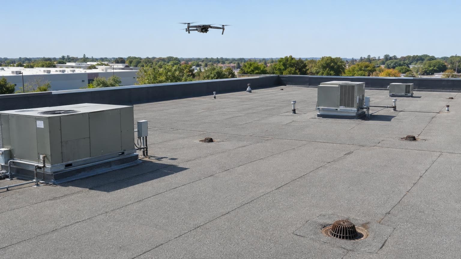
In a 2020 study, Clemson University researchers tested a 20-year-old multi-ply modified bitumen roof on a public university building. A drone flew a preset path about 50 feet above the roof with 80% photo overlap, and a second drone with 30x optical zoom shot penetrations and flashings. The same inspector reviewed the 3D model first, then walked the roof two days later.1
| 3D model | In person | |
|---|---|---|
| Date | August 5, 2019 | August 7, 2019 |
| Inspection time | 78 minutes, plus 25 minutes of flight and modeling | 45 minutes |
| Deficiencies found | 191 | 200 |
| Blistered area | 7 sq ft | 61 sq ft |
| Blocked gutters and downspouts | 0 | 3 |
| Roof penetrations counted | 10 | 10 |
Counts of open laps, alligatoring, punctures, wrinkles and edge damage on the model came within 20% of the in-person counts. Blisters, drains, gutters and damage around penetrations, which need a section view, did not.1
Where you'll see it
- Portfolio roof programs: an owner of many buildings surveys each roof on a cycle and tracks condition and spending in one database. The District of Columbia sought a consultant to survey 409 buildings with about 12.65 million square feet of roof every year, linking each photo to its defect and roof plan location in a web-based database.2
- Condition assessment reports: each building's report rates membrane, perimeter flashings, projection flashings, sheet metal and drainage, gives an estimated remaining service life and sets a 10-year budget.2
- Delaware: the Department of Insurance's Bulletin No. 150, dated March 21, 2025, notes that insurers use drone imagery in claims, loss assessments and underwriting, and that the images can suffer from distortion, weather interference and missed fine detail.3
Questions
- Can a drone inspection replace walking the roof?
- Partly. A model shows surface defects well but misses what needs a close or side view. In the Clemson test, the inspector found 191 deficiencies on the 3D model and 200 in person, but the model showed 7 of 61 square feet of blistering and none of the 3 blocked gutters and downspouts. The authors said a protocol for when an in-person inspection is required still needs research.1
- Do you need a license to fly a drone for roof inspections?
- For work or business, the FAA requires a drone under 55 pounds to be registered and flown under Part 107 by a pilot with a remote pilot certificate. Earning the certificate takes passing a knowledge test at age 16 or older.4
- How high can a drone fly over a building?
- Up to 400 feet above ground level. Within a 400-foot radius of a structure, it may fly up to 400 feet above the structure's highest point.5
- Can an insurer cancel a policy based on drone images of a roof?
- Rules vary by state. Delaware's bulletin says cosmetic issues such as discoloration and streaking are not valid grounds for cancellation. It expects insurers to give customers access to the images used and recommends a physical inspection when a customer disputes the finding.3
Cloudbreak
Cloudbreak keeps every policy, statement of values and loss run in one place per property, tracks renewals, and watches every building against storms with its proprietary predictive storm engine, built with AI and backed by meteorologists.
Sources
Written by the Cloudbreak team. Numbers, dates and rules cite the published sources below.
- 1. Clemson University, EPiC Series in Built Environment: Evaluating the Use of Unmanned Aerial Systems (UAS) to Perform Low-Slope Roof Inspections
- 2. District of Columbia Department of General Services: Roof Management System Operations and Maintenance: Section B Scope of Work
- 3. Delaware Department of Insurance: Domestic and Foreign Insurers Bulletin No. 150: Use of Unmanned Aircraft Systems in Insurance Practices (Aerial Imagery)
- 4. Federal Aviation Administration: Certificated Remote Pilots including Commercial Operators
- 5. Electronic Code of Federal Regulations: 14 CFR 107.51: Operating limitations for small unmanned aircraft