Hurricane Edith (1971)
Hurricane Edith was a Category 4 hurricane at its peak, with 150 mph winds and a lowest pressure of 943 mb, per NOAA's National Hurricane Center. Modeled winds reached tropical-storm force (39 mph) at 6 of the cities we track; the strongest was Lafayette, LA, with a modeled peak gust of 75 mph.
- Peak strength150 mph winds (1-minute)
- Category 4
- Cities with tropical-storm-force windsModeled, of the cities we track
- 6
- LandfallsFirst September 9, 1971
- 3
- Lowest pressure
- 943 mb
Track, wind field and cities
Select a piece of the track or a city for details.
- Depression or weaker
- Tropical storm
- Hurricane, Category 1 or 2
- Major hurricane, Category 3 to 5
- Landfall
- City (larger ring, stronger modeled gust)
- Modeled wind field, 39 to 111 mph sustained (darker, stronger; orange 111 mph+)
The shaded areas are where our model puts Hurricane Edith’s sustained winds over open land at 39 mph or more (tropical-storm force), 58, 74 (hurricane force) and 111 mph (major hurricane force) at some point along its track. Modeled, not measured. How we model hurricane winds
Landfalls
- September 9, 1971, Category 4 at 150 mph, in Nicaragua
- September 11, 1971, tropical storm at 69 mph, in Belize
- September 16, 1971, Category 1 at 92 mph, about 48 miles from Lake Charles, LA
Modeled winds at cities (6)
Estimated peak winds for open, flat ground at each city’s center. Not measurements. How we model hurricane winds
| City | Peak gust | Sustained | Closest pass | Peak |
|---|---|---|---|---|
| Lafayette, LA | 75 mph | 61 mph | 2 miles | Sep 16, 1971, 10:15 AM CDT |
| Baton Rouge, LA | 74 mph | 60 mph | 22 miles | Sep 16, 1971, 1:00 PM CDT |
| Lake Charles, LA | 66 mph | 53 mph | 47 miles | Sep 16, 1971, 6:45 AM CDT |
| Beaumont, TX | 56 mph | 45 mph | 73 miles | Sep 16, 1971, 6:30 AM CDT |
| Brownsville, TX | 54 mph | 44 mph | 61 miles | Sep 15, 1971, 6:45 AM CDT |
| League City, TX | 51 mph | 42 mph | 81 miles | Sep 16, 1971, 2:30 AM CDT |
What happened
After crossing Central America and Mexico, Edith regained hurricane strength over the Gulf and moved inland near Pecan Island in southwest Louisiana on September 16, 1971.1,2 NHC's best track puts landfall at 1300 UTC (8 a.m. CDT) with 80-knot (92 mph) winds, a Category 1 hurricane, and a 978 mb central pressure.3
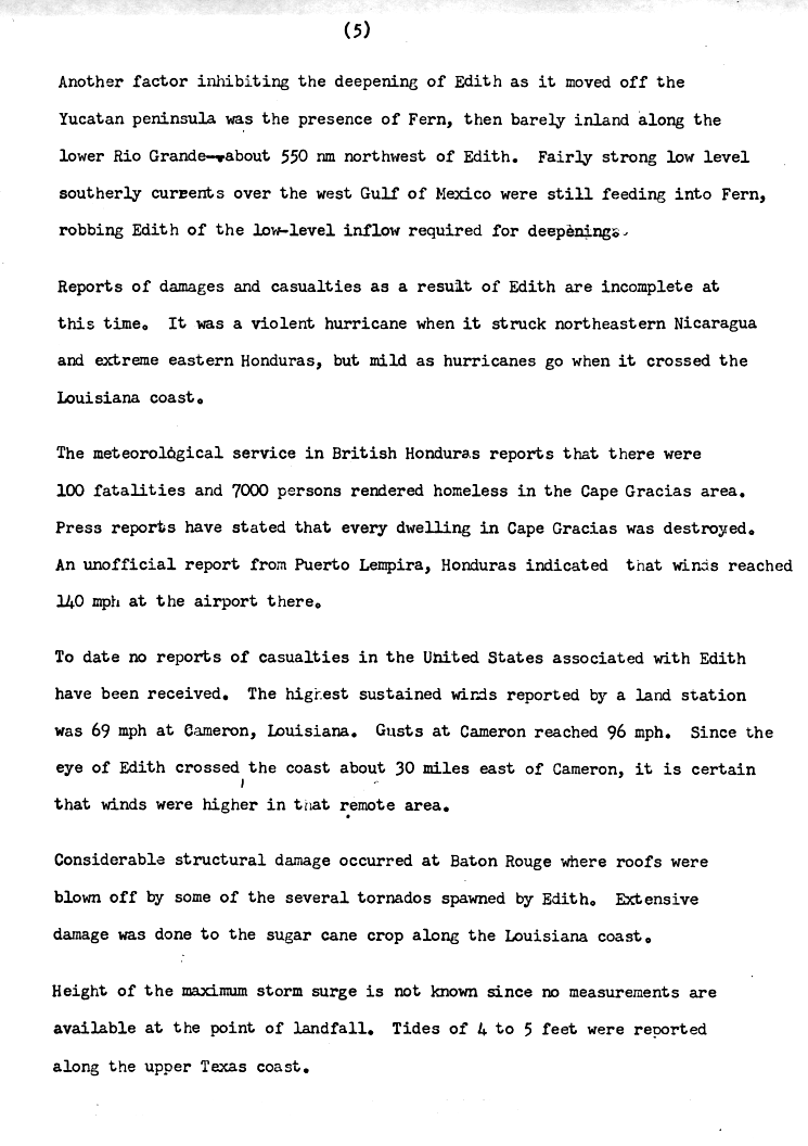
Cameron, about 30 miles west of where the eye came ashore, measured 69 mph sustained winds and a 96 mph gust. Morgan City had gusts to 72 mph and Lafayette to 69 mph.4,1 Storm surge ran 5 to 8 feet along the Louisiana coast, highest in Vermilion and Cote Blanche bays. In Texas, a 6-foot surge flooded Highway 87 between Sabine Pass and High Island.1,5 Edith spawned several tornadoes. NHC reported considerable structural damage in Baton Rouge, where tornadoes blew roofs off, and the worst tornado tracked seven miles in East Baton Rouge Parish.4,1
Sources
- 1. National Weather Service: Louisiana Hurricane History
- 2. NOAA Weather Prediction Center: Hurricane Edith, September 12 to 19, 1971
- 3. NOAA National Hurricane Center: Atlantic hurricane database (HURDAT2), 1851 to 2025
- 4. NOAA National Hurricane Center: Preliminary Report, Hurricane Edith, September 5 to 17, 1971 (page 5)
- 5. NOAA Weather Prediction Center: Texas Hurricane History
Best track (55 positions)
| Time | Status | Wind | Pressure | Position |
|---|---|---|---|---|
| Sep 5, 18:00 UTC | Tropical depression | 29 mph | 1010 mb | 11.4°N, 57.7°W |
| Sep 6, 00:00 UTC | Tropical depression | 35 mph | 11.6°N, 59.4°W | |
| Sep 6, 06:00 UTC | Tropical depression | 35 mph | 11.8°N, 61.1°W | |
| Sep 6, 12:00 UTC | Tropical depression | 35 mph | 12.0°N, 62.8°W | |
| Sep 6, 18:00 UTC | Tropical depression | 35 mph | 12.2°N, 64.4°W | |
| Sep 7, 00:00 UTC | Tropical depression | 35 mph | 12.3°N, 66.0°W | |
| Sep 7, 06:00 UTC | Tropical storm | 40 mph | 12.5°N, 67.7°W | |
| Sep 7, 12:00 UTC | Tropical storm | 52 mph | 1006 mb | 12.7°N, 69.3°W |
| Sep 7, 18:00 UTC | Tropical storm | 69 mph | 995 mb | 12.9°N, 70.9°W |
| Sep 8, 00:00 UTC | Tropical storm | 69 mph | 13.1°N, 72.4°W | |
| Sep 8, 06:00 UTC | Category 1 hurricane | 75 mph | 993 mb | 13.3°N, 73.9°W |
| Sep 8, 12:00 UTC | Category 1 hurricane | 81 mph | 13.6°N, 75.6°W |