Hurricane Cindy (1959)
Hurricane Cindy was a Category 1 hurricane at its peak, with 75 mph winds and a lowest pressure of 995 mb, per NOAA's National Hurricane Center. Modeled winds reached tropical-storm force (39 mph) at 3 of the cities we track; the strongest was Charleston, SC, with a modeled peak gust of 71 mph.
- Peak strength75 mph winds (1-minute)
- Category 1
- Cities with tropical-storm-force windsModeled, of the cities we track
- 3
- LandfallsFirst July 9, 1959
- 2
- Lowest pressure
- 995 mb
Track, wind field and cities
Select a piece of the track or a city for details.
- Depression or weaker
- Tropical storm
- Hurricane, Category 1 or 2
- Major hurricane, Category 3 to 5
- Landfall
- City (larger ring, stronger modeled gust)
- Modeled wind field, 39 to 111 mph sustained (darker, stronger; orange 111 mph+)
The shaded areas are where our model puts Hurricane Cindy’s sustained winds over open land at 39 mph or more (tropical-storm force), 58, 74 (hurricane force) and 111 mph (major hurricane force) at some point along its track. Modeled, not measured. How we model hurricane winds
Landfalls
- July 9, 1959, Category 1 at 75 mph, about 25 miles from Charleston, SC
- July 11, 1959, tropical storm at 58 mph, 41.7°N, 70.7°W
Modeled winds at cities (3)
Estimated peak winds for open, flat ground at each city’s center. Not measurements. How we model hurricane winds
| City | Peak gust | Sustained | Closest pass | Peak |
|---|---|---|---|---|
| Charleston, SC | 71 mph | 58 mph | 24 miles | Jul 8, 1959, 7:45 PM GMT-4 |
| Myrtle Beach, SC | 56 mph | 45 mph | 63 miles | Jul 8, 1959, 7:45 PM GMT-4 |
| Hilton Head Island, SC | 48 mph | 39 mph | 86 miles | Jul 8, 1959, 7:45 PM GMT-4 |
What happened
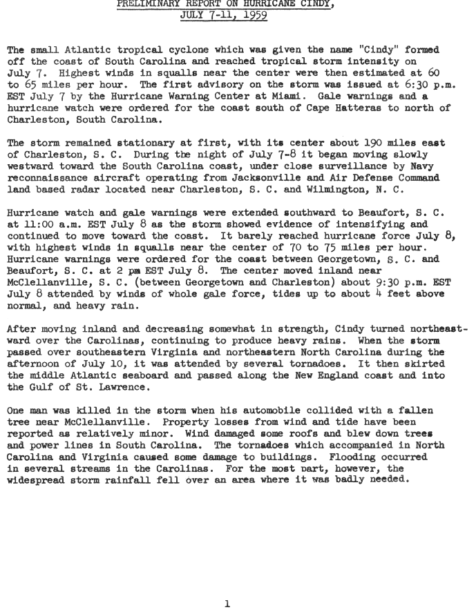
Cindy formed off the South Carolina coast on July 7, 1959, and barely reached hurricane strength on July 8, with top winds of 70 to 75 mph in squalls near its center.1 Its center moved inland near McClellanville, between Georgetown and Charleston, about 9:30 p.m. EST on July 8, and NWS Charleston lists it as a Category 1 hurricane at landfall.1,2 Tides reached about 4 feet above normal at landfall.1
In South Carolina, wind damaged some roofs and brought down trees and power lines, and the Weather Bureau called property damage from wind and tide relatively minor.1 One death was reported, near McClellanville.1 On the afternoon of July 10, tornadoes with the storm caused some damage to buildings in northeastern North Carolina and southeastern Virginia.1
Sources
- 1. U.S. Weather Bureau, NOAA National Hurricane Center archive: Preliminary Report on Hurricane Cindy, July 7-11, 1959
- 2. NWS Charleston: Hurricane Gracie: Sep 29, 1959
Best track (35 positions)
| Time | Status | Wind | Pressure | Position |
|---|---|---|---|---|
| Jul 4, 12:00 UTC | Tropical depression | 29 mph | 31.5°N, 79.0°W | |
| Jul 4, 18:00 UTC | Tropical depression | 29 mph | 31.0°N, 79.0°W | |
| Jul 5, 00:00 UTC | Tropical depression | 29 mph | 30.5°N, 78.9°W | |
| Jul 5, 06:00 UTC | Tropical depression | 29 mph | 30.0°N, 78.7°W | |
| Jul 5, 12:00 UTC | Tropical depression | 29 mph | 29.8°N, 78.5°W | |
| Jul 5, 18:00 UTC | Tropical depression | 29 mph | 29.8°N, 78.3°W | |
| Jul 6, 00:00 UTC | Tropical depression | 29 mph | 30.0°N, 78.2°W | |
| Jul 6, 06:00 UTC | Tropical depression | 29 mph | 30.3°N, 78.0°W | |
| Jul 6, 12:00 UTC | Tropical depression | 35 mph | 30.5°N, 77.9°W | |
| Jul 6, 18:00 UTC | Tropical storm | 40 mph | 30.8°N, 77.7°W | |
| Jul 7, 00:00 UTC | Tropical storm | 46 mph | 31.3°N, 77.4°W | |
| Jul 7, 06:00 UTC | Tropical storm | 46 mph | 31.8°N, 77.2°W |